Right now there are three naked eye planets easily seen in the evening / night time sky. Jupiter and Saturn are visible as the sky darkens after sunset. Jupiter will be a bright enough object that it can be viewed during dusk. Saturn will be just east of Jupiter, a little lower, noticeably fainter and will need a darker sky to be seen. Ultimately, Mars will join the other two in the sky around 2200(CDT) when it rises above the eastern horizon.
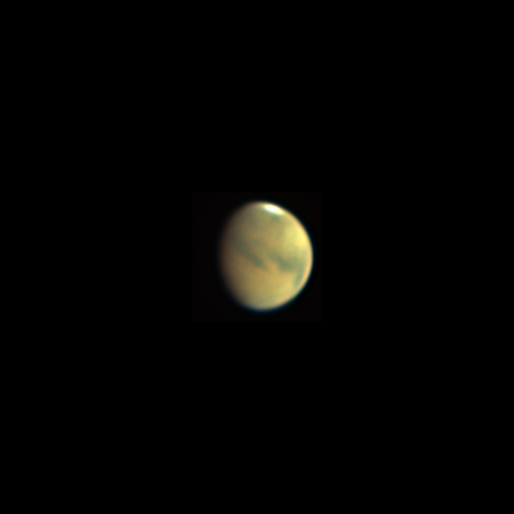
These pictures were all taken on the evening of the 17th / morning of the 18th of August. Jupiter and Mars are oriented south up; Saturn is north up.
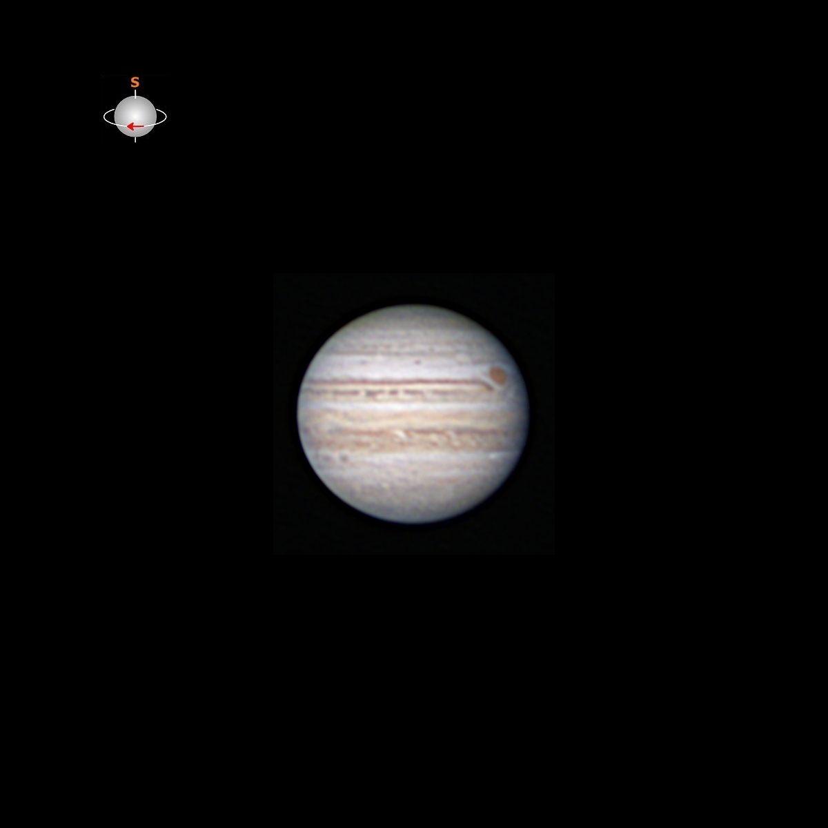
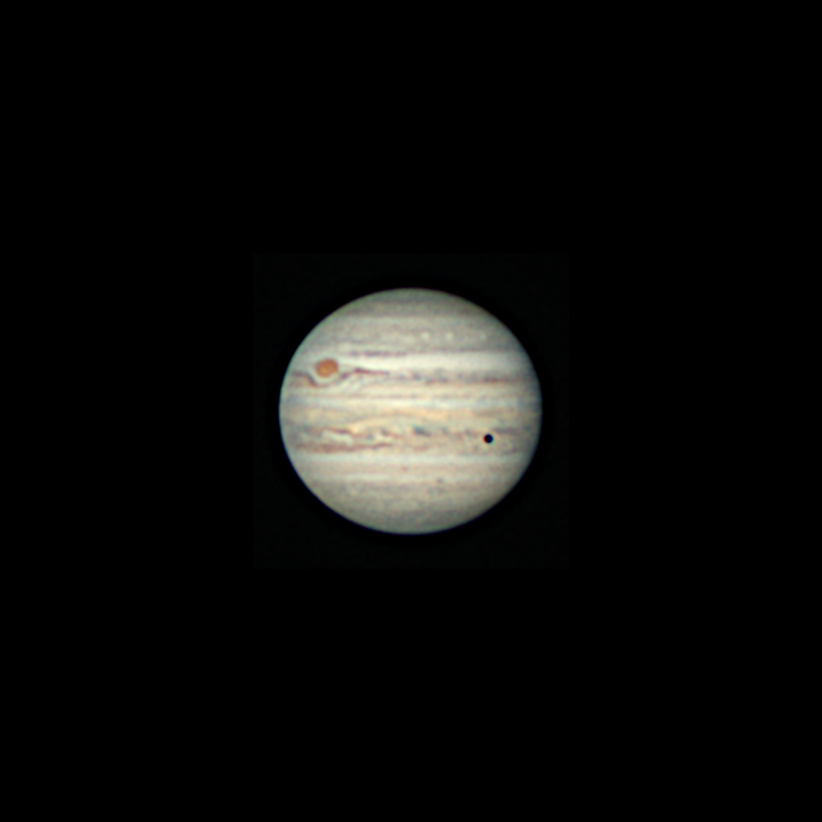
When this image was taken, the GRS was just about to rotate around to the far side of the planet. Just coming on to the near side above the North Temperate Belt (NTB) is the small dark shadow of the Jovian moon Europa. The moon is visible but very hard to identify as it is also in front of the NTB but almost directly below the GRS. To ID the cloud bands see Jupiter’s belts and zones.
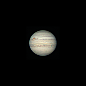
Jupiter, GRS & Europa’s shadow
[(V)R:1211×1.57ms;
G:1260×1.70ms;
B:1260×2.91ms]
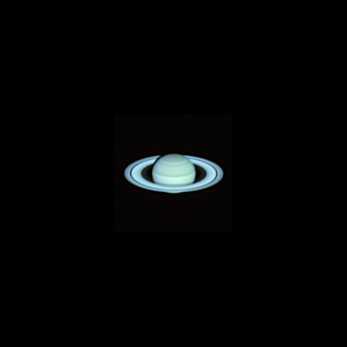
Right now, Saturn is in the portion of its orbit where we are looking down on the ring plane. This is why I rotated the image 180° from the view in the telescope. Now we see the rings as they truly are. Our view of the upper side of the rings will remain until March 2025 when we will see the ring plane edge on. At that time the rings will be nearly invisible. Saturn will continue on in its orbit and our view will shift to the underside of the rings for the next 14.5 years.
If you look closely, you can see a bit of Saturn’s shadow on the far side rings and you can see some of the planet’s disk through the Cassini division and just a bit of it below the rings.
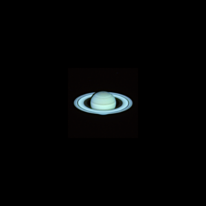
Saturn
[(V) R:3597×2.81ms;
G:3591×7.27ms;
B:1826×16.32ms]
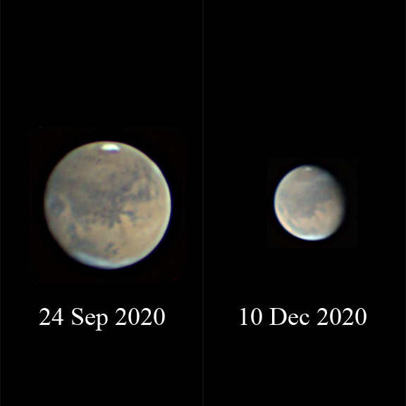
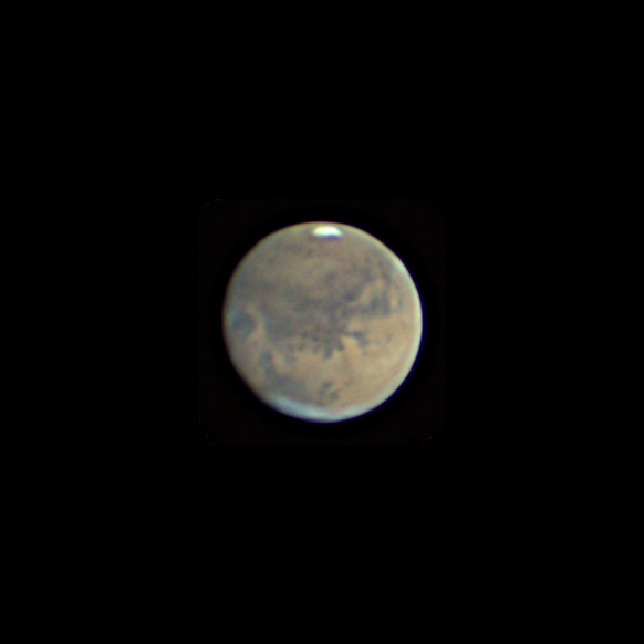
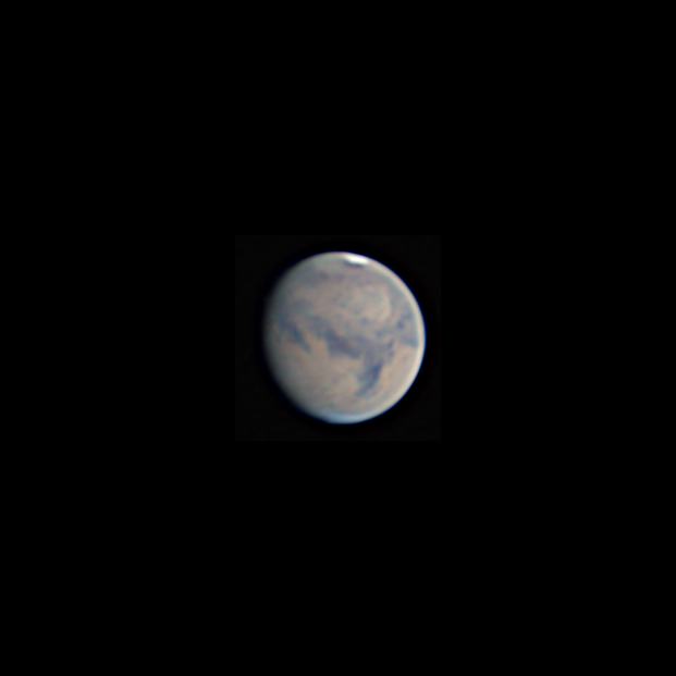
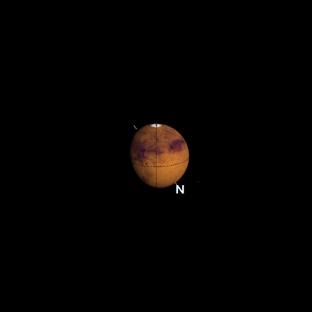
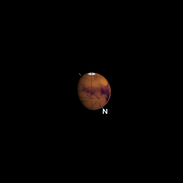
The most obvious object in this image of Mars is the southern ice cap. There is a distinct notch in the lower edge. Mars was at perihelion on the 3rd of August. The southern hemisphere season is heading towards summer and the ice cap we see is starting to shrink.
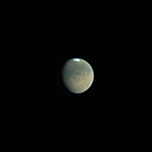 Mars
[(V) R:6838×0.21ms;
G:6837×0.35ms;
B:6832×0.73ms] |
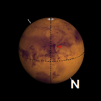
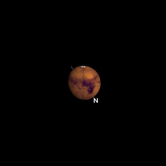
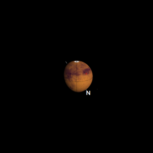 The Mars illustration is courtesy of WinJUPOS. |
For an explanation of caption information see exposure data.