Dec 102018
 

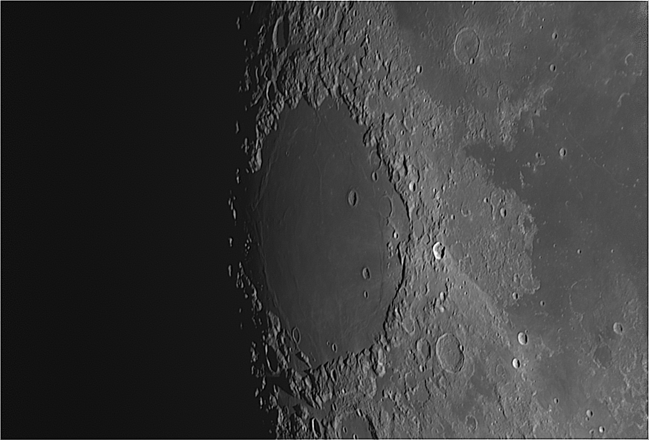
There will be several visible events this coming week. Two for everyone and a couple more for those of you on the Florida panhandle.

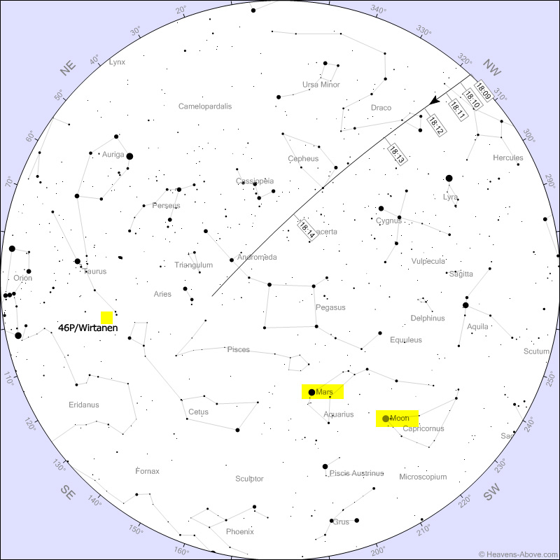
We have two excellent ISS passes this week for those of you in the panhandle. The first will be on the evening of the 12th. The station will clear the horizon at 18:09, travel from the NW to the SE but drop into the Earth’s shadow high overhead about 18:15. Watch for it to redden as the station experiences sunset.
 

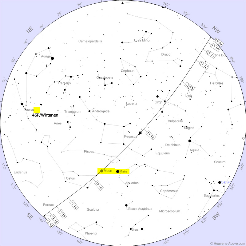
The second ISS pass will be on the evening of the 15th. The station will clear the horizon an hour earlier at 17:09, once again travel from the NW to the SE and drop below the horizon at 17:19. Notice how close the ISS will come to the Moon. In fact, for some of you in a very narrow path, the ISS will cross the face of the Moon (a transit).

 
For everyone else the items of interest are the comet 46P/Wirtanen and the Geminid meteor shower. Comet 46P/Wirtanen is a periodic comet (hence the P in the name) that orbits the Sun every 5.4 years. This time the 3/4 mile wide comet will close to within 7.1 million miles of the Earth on the 16th. That’s roughly 30 times the distance to the Moon. I have annotated the location of the comet on each of the ISS charts, however, it will be much easier to see later in the evening as it gets higher in the sky. It will be highest at 21:50 on the 12th and at 22:02PM on the 15th. Notice how much it will move between the 12th and the 15th. It has been reported to be naked eye visible now but you will still need a dark clear sky to see it. Binoculars will make it a bit easier. It will look like a faint fuzzy ball. Photo’s just barely show a tail so I don’t expect to see one visually.

You won’t need binoculars to see the denizens of the Geminid meteor shower. The shower is already underway but predicted to peak around 04:00 (CST) on the morning of the 14th. As usual for meteor showers, a dark clear sky is needed. Just find an area with as much clear horizon as you can, get comfortable (read warm clothing) and look up. The meteors can appear anywhere in the sky. Right now the shower’s radiant clears the horizon about 18:30 PM and is high overhead by 02:15. The darker the sky and the higher the radiant, the better your chances will be to see some of the meteors.

 Posted by at 13:40
Oct 202018
 

Taken only two days from full, the only part of the Moon with any shadows are the limbs. This image is of the western limb centered on the crater Lohrmann. The 19 mile wide crater is circular but does not look it due to foreshortening. The crater lies between the crater Grimaldi to the south and Hevelius to the north. Most of the unlabeled craters are unnamed and identified by a letter associating it with a adjacent named crater. These are known as satellite craters or satellite features. For example, see Flamsteed T at the upper left of the image. Crater Flamsteed is well off the left edge.

Of note is the extensive fractured surface (rimae) inside and out of crater Hevelius.

Moon [(V)L:657×0.9ms] (mouse over for labels)

Crater Lohrmann is named for Wilhelm Gotthelf Lohrmann (1796 – 1840). Born in Dresden, he was a cartographer, astronomer and meteorologist. Using his own observations he started producing a set of lunar maps in 1821. Although completed in 1836 they were not published until 1878, well after his death. He is also honored by asteroid (4680) Lohrmann.

 Posted by at 12:02
Aug 262018
 

I am still concentrating on planetary/lunar imaging while my deep space camera is getting an improved power supply. The curving mountain range defines the eastern edge of the large impact basin, Mare Imbrium, thought to have been formed when a large object impacted the Moon during the late heavy bombardment era (4.1-3.8 billion years ago).

Exposure Data [(V)L:240×6.9msec]


The flat area right of Mare Imbrium is Sinus Aestuum (Seething Bay), another lava filled plain considered a part of Mare Insularum (Sea of Islands). The image below is the same image but annotated to identify the geological elements.

Map generated with Virtual Moon Atlas

The large central crater is Eratosthenes. It was estimated to have formed 3.2 billion years ago and is 35 miles across and 2.25 miles deep. It is named after the Greek astronomer Eratosthenes of Cyrene (≈276-174 BC), considered the father of geography. He was chief librarian at the library of Alexandria, and is credited with estimating the Earth’s circumference and the tilt of Earth’s axis of rotation, both with surprising accuracy. He also invented the concept of the leap day.

 Posted by at 14:42
Jul 012018
 

The large smooth circular area is Mare Crisium (Sea of Crises). The 345 mile wide impact basin is located on the eastern side of the Moon just north of the equator. The impact that formed the basin is estimated to have occurred 4.5 to 3.8 billion years ago. The surface lies a little more than a mile below lunar ‘sea level’. Samples of the mare were retrieved by the Soviet Union’s Luna 24 lander and returned to the Earth in 1976.
 

The largest non-lava filled crater in the mare is Picard. No, not that Picard. It is named for Jean-Félix Picard, a 17th French astronomer, priest and geodesist. He pioneered the method for measuring the right ascension of a celestial object by measuring the time it crosses the observer’s meridian. His method became the accepted standard.

Two other craters, this time lava filled, are Lick and Yerkes. Both named after American philanthropists involved with 19th century astronomy.

James Lick provided funds for the construction of Lick Observatory, the first permanently staffed mountain top observatory in the world.

Charles T. Yerkes provided the funds for the construction of Yerkes Observatory and the 40″ achromatic refracting telescope housed there. The telescope remains the largest refractor telescope ever used for scientific research.


The source video for this image was taken on the morning of June 30 just as the Sun was setting on the eastern edge of the mare. The image is the best 20% of 1801 frames taken at an average of 15 frames per second. The frames were analyzed and stacked using AutoStakkert 2 and wavelet sharpened by RegiStax 6.0. All the lunar images are south at the top.

 Posted by at 16:56
Jul 012018
 

This image, taken on the 20th of June, encompasses the area that appears to join two of the major ‘seas’ on the Moon. Toward the left is Mare Imbrium (Sea of Showers). Toward the right is Mare Serenitatis (Sea of Serenity). The line between the dark (nighttime) side and the bright (daytime) side is called the terminator.

Even though most of Mare Imbrium is deep in shadow, a couple of objects do stand out. The most prominent is the bright ‘T’ shaped object left of the terminator half way up from the image center. This is Mons Piton. The mountain’s peak at 8,366 feet is high enough that it is in sunlight while the surrounding terrain is still in the shadow of the Moon. Another object visible in the shadows is the eastern rim of the crater Archimedes. The crater is left of the terminator and slightly southwest of crater Autolycus. The rim is not as high as Mons Piton so there is less in the light.

One other object of note is right of the terminator in the mountainous region toward the bottom. It is a mountain labeled Mons Hadley. Left of the the peak down in the shadows is Hadley Rille. The sinuous rille is about 80 miles long and was the primary target of study by Apollo 15. The rille is just west of Falcon’s landing site. Astronauts David Scott and James Irwin spent 3 days in the vicinity of the rille. At the landing location the rille was estimated to be about 1,200 feet deep and roughly 3,200 feet across.

 Posted by at 12:34